Mt Bealey Route
WARNING: Because of continuing problems encountered on this route by walkers please take note of the following advise...
- This is a "day walk", leave early to allow for sufficient daylight hours.
- If there is a poor weather forecast do not attempt this route. If there is fog/cloud cover on the mountain turn around.
- TELL SOMEONE YOUR PLANS, and remember to let them know when you return safely.
- Do not walk alone on this route, find an appropriate partner.
- Take sufficient clothing, food, water & medical needs to be able to survive a night out in cold wet conditions. Search & Rescue activity should commence the day following your intended "out date".
- Test your cellphone in Arthur's Pass Village, if it works there, take it with you, it should work on all Village side aspects of this mountain, if you get lost or in trouble call 111. Don't waste your phone battery! Phones can be an unreliable way of getting help. Better still take a PLB with you as well (Arthur's Pass Visitor Centre hires them).
- If you become lost, retrace your steps if possible to refind the correct route. If you cannot, find shelter (rocks, trees, tussocks), stay where you are.
- DO NOT push into the treeline too far except to seek shelter, there are large hidden cliffs and alternate ways down DO NOT exist. If you are not on the marked track (orange triangles) STOP!
- DO NOT follow streams/creeks off the mountain, many of these go over very large waterfalls or contain extensive loose rock.
- If you see searchers (helicopter, ground crews) attract attention by moving to open ground, yelling, waving bright clothing. If you are injured leave something bright in clear view near you in case you lose consciousness.
- At night you can signal towards the Village (street lights are visible) by triggering your camera flash on every hour.
HAVE A "PLAN B": If Mt Bealey is out of condition with poor visibility/rain/wind, consider the Bealey Spur Track as an alternative. The weather can be much finer east of Arthur's Pass.
Area Brochure: Discover Arthur's Pass Booklet (19MB)
Area Brochure: Discover Arthur's Pass Booklet (19MB)
Mt Bealey Route
Track Grade: Tramping Track & Unmarked RouteWalking Time: 6 to 8 hours return
Features: Mountain climb, Beech forest, views down the Waimakariri Valley.
Location: 1km from the Visitor Centre towards Christchurch. The track starts from a small carpark, halfway up the Mt Bealey Road.
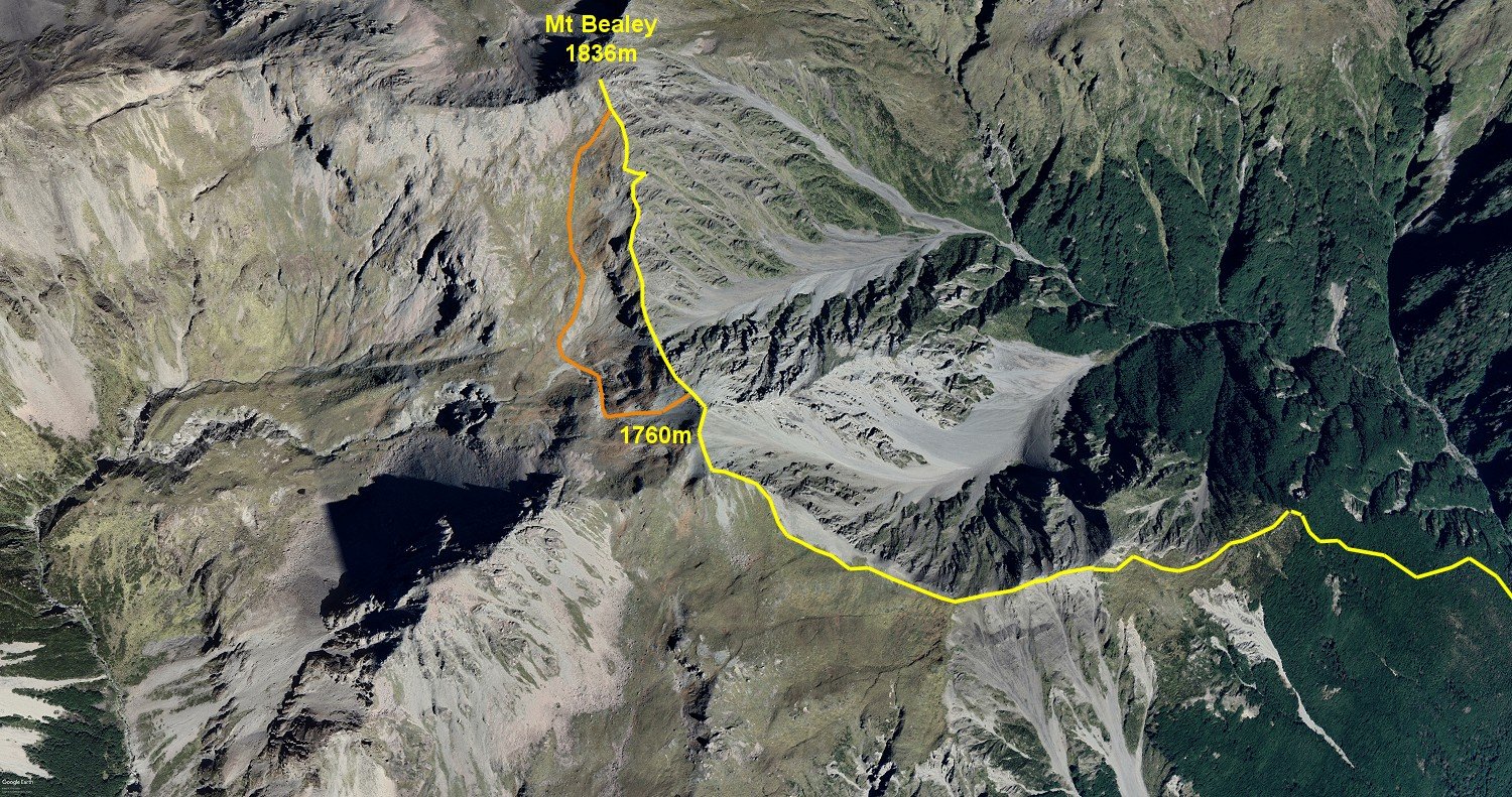
Description: A steep tramping track zig-zags through the beech forest onto the main ridge leading to Mt Bealey.
The unmarked route then follows the tussock covered and rocky ridge to the summit of the Low Peak of Mt Bealey (1760m).
Drop down into the notch between High & Low Peaks. The ridge has some steep and loose sections so extreme care should be taken. An alternate is to drop down the scree to the south about 80m, and skirt around the bluffs of the ridge on steep but easier ground, aiming directly for the summit.
RETURN EXACTLY THE SAME WAY YOU WENT UP!