(Move mouse over image to view image text)
NORTHERN VIEW: The above image represents a HD wide angle view looking north from Arthur's Pass Village towards Arthur's Pass proper (920m) with ridges running west (left) towards Avalanche Peak and Mt Rolleston (Rome & Goldney). Treeline is at about 1300m. The image is updated every 15 minutes. Click Here to open a 14 hour timelapse.
Click Here to view full size image (1920x1080 200KB).
|

(Move mouse over image to view image text)
WESTERN VIEW: The above image represents a HD wide angle view looking west from Arthur's Pass Village towards Lyell Peak (1828m) with ridges running south (left) towards Mt Bealey and north (right) towards Avalanche Peak. Treeline is at about 1300m. The image is updated every 15 minutes. Click Here to open a 14 hour timelapse.
Click Here to view full size image (1280x720 200KB).
|

(Move mouse over image to view image text)
TEMPLE BASIN VIEW: The above image represents a HD wide angle view looking east from the Arthur's Pass Repeater Site towards Temple Basin with Phipps Peak (left), Mt Temple, Blimit, Mt Cassidy (right). The image is updated every 15 minutes. Click Here to open a 14 hour timelapse.
Click Here to view full size image (1920x1080 200KB).
Click Here to view weather station data associated with this camera location.
|

(Move mouse over image to view image text)
BEALEY VALLEY VIEW: The above image represents a HD wide angle view looking south from the Arthur's Pass Repeater Site towards Arthur's Pass Village with Mt Cassidy (left). The image is updated every 15 minutes. Click Here to open a 14 hour timelapse.
Click Here to view full size image (1920x1080 200KB).
Click Here to view weather station data associated with this camera location.
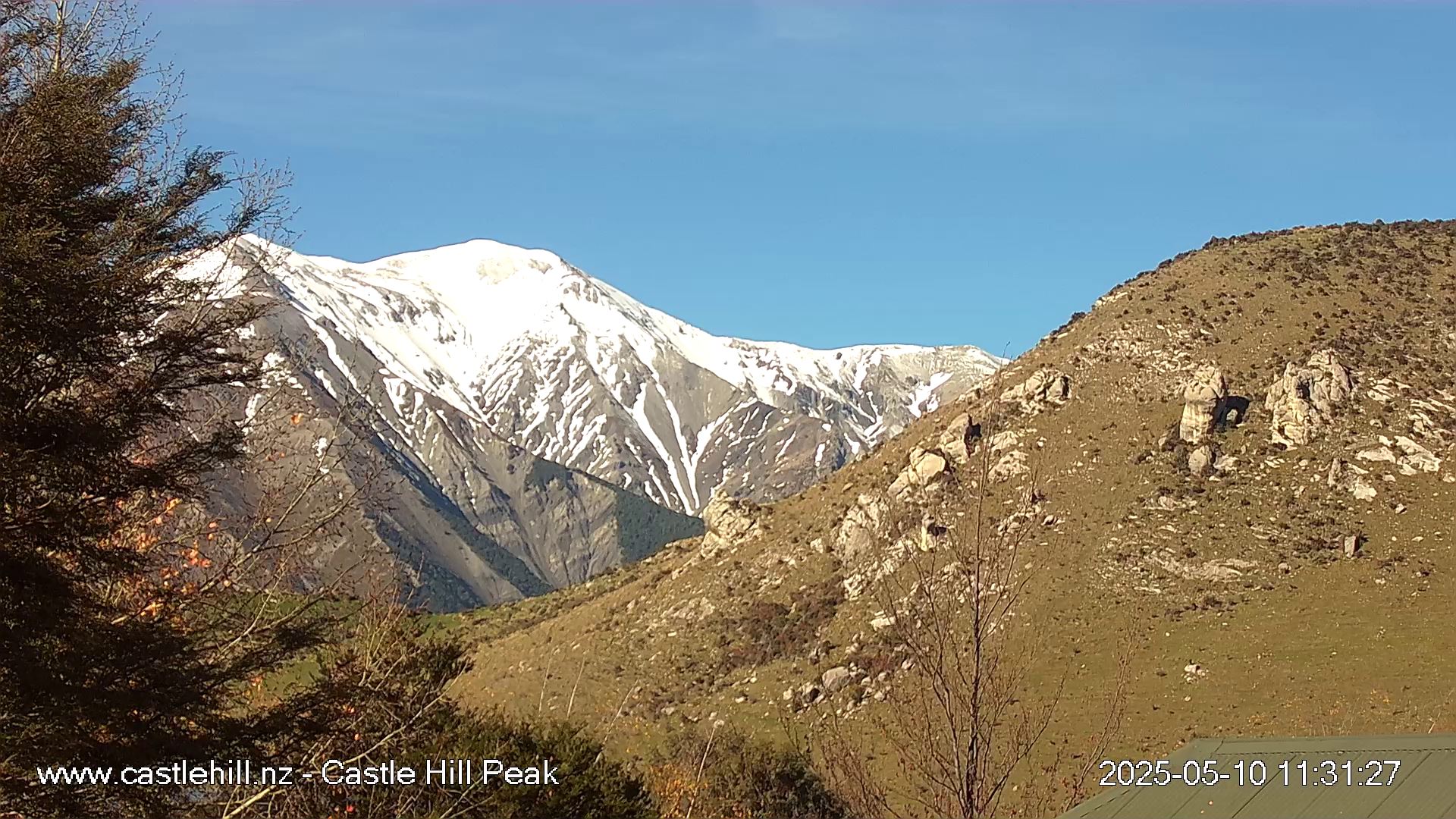
CASTLE HILL PEAK VIEW: The above image is provided with permission by www.castlehill.nz. The view is Castle Hill Peak 1998m (Torlesse Range) from Castle Hill Village.
MT CLOUDESLEY VIEW: The above image is provided with permission by www.castlehill.nz. The view is Mt Cloudesley 2107m (Craigieburn Range) from Castle Hill Village.
|
The above image represents a view looking south from Arthur's Pass Village looking down the Bealey Valley towards the Black Range. Treeline is at about 1400m. The image is updated every 5 minutes. Clicking on the image will open a new window containing a 24 hour timelapse.
|
Other WebCam Links
Local Skifield Webcams
Local Area Webcams
Other New Zealand Webcams
Overseas Webcams
|